CAP Activator Mapping
The four types of CAP services use different mapping rules.
-
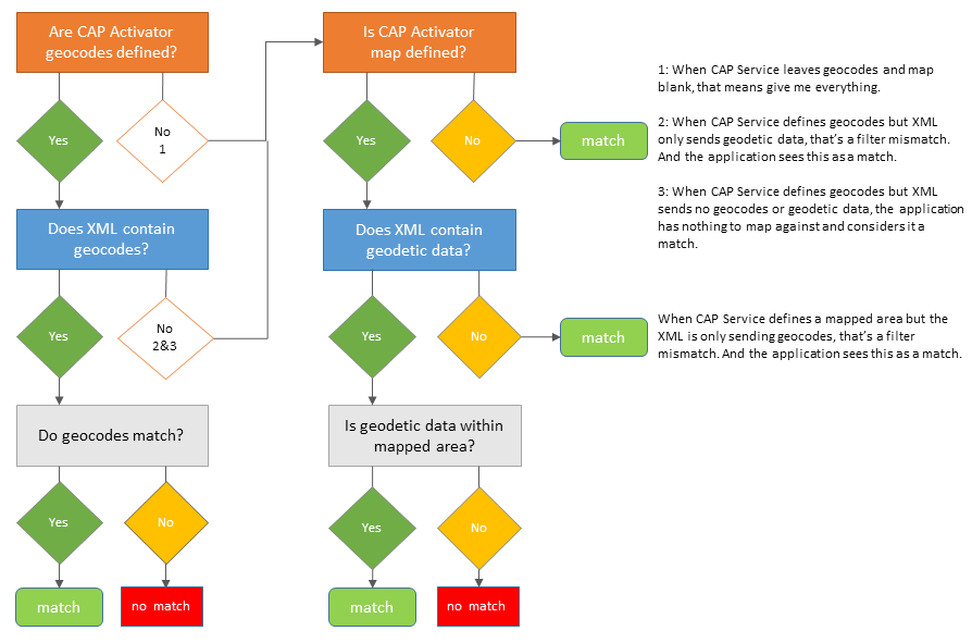
Generic CAP service – uses geocodes and geodetic data. See Mapping Rules: Geocodes and Geodetic mapping.
-
IPAWS service – uses geocodes and geodetic data. See Mapping Rules: Geocodes and Geodetic mapping.
-
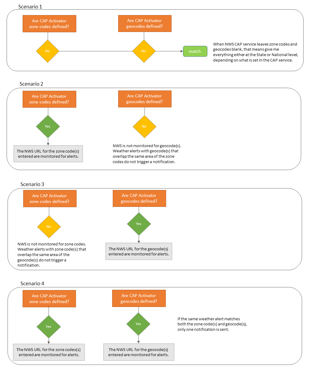
NWS feed – uses geocodes and zone codes. See Mapping Rules: Geocodes and Zone Codes
-
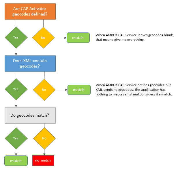
AMBER Alert feed – uses geocodes. See Mapping Rules: Geocodes Only
AMBER CAP alerts only utilize geocodes, so mapping is pretty straight forward.
The geographic location being monitored is contained in the <area> sub-element of the <info> element in the CAP XML.

In order for a notification to be triggered, the incoming CAP XML must match the Revolution CAP service mapping. The external CAP service provider chooses how to define geographic areas – Geocodes, Geodetic data (map coordinates), both types, or neither. CAP XML can also be sent that contains neither geocodes nor geodetic data. Look at the Homeland Security example in the CAP v1.2 spec. It only contains an area description. It doesn't contain geocodes or geodetic data. That means the Homeland Security Alert applies to the whole United States and beyond.
So, how does the CAP Activator match location?

The geographic location being monitored is contained in the <area> sub-element of the <info> element in the CAP XML.
IPAWS uses a bit of additional filtering.
- Geocodes ending in 000 indicate the entire state. Let's say you're filtering on Dallas County for Dallas, Texas (FIPS6 code 48113 – 48 is the code for the state of Texas + 113 is the code for Dallas County). An IPAWS alert is received with a geocode of 48000. This code applies to the entire state of Texas, therefore it's a match for Dallas County.
- Geocodes that are 000000 indicate the entire United States. These are always a match.
NWS weather alerts have two feeds – one that uses zone codes and one that uses geocodes. Which feed Revolution monitors for mapping depends on how your NWS service is set up.

